Your Home Isn't in a Flood Zone — Until FEMA Decides It Is

The Map That Changes Everything
You did your homework before buying. You checked the flood maps, confirmed your dream home sat safely outside any flood zone, and breathed easy knowing you'd avoid those hefty flood insurance premiums. Your mortgage lender agreed — no flood insurance required.
Then, three years later, a letter arrives from FEMA. Your neighborhood has been remapped. Your house, previously considered safe, now sits in a high-risk flood zone. Flood insurance isn't just recommended anymore — it's mandatory. Welcome to one of homeownership's least predictable financial surprises.
How FEMA's Mapping Really Works
FEMA's flood maps feel permanent when you're house hunting, like geological features etched in stone. In reality, they're living documents that get redrawn regularly as the agency updates its understanding of flood risk. These updates happen for several reasons: new development changes water flow patterns, climate shifts alter precipitation, aging infrastructure affects drainage, or simply better data becomes available.
The remapping process is exhaustive but slow. FEMA studies rainfall patterns, river flows, topography, and development patterns. They run computer models, analyze historical flood data, and consult with local officials. The entire process can take years from start to finish.
During this time, homeowners live with the old maps, making major financial decisions based on information FEMA knows is outdated. By the time new maps are released, the flood risk they describe might have existed for years.
When Safe Becomes Risky Overnight
The Harris County area around Houston provides a stark example. Before Hurricane Harvey in 2017, thousands of homes sat outside mapped flood zones. Many homeowners had no flood insurance — why would they need it?
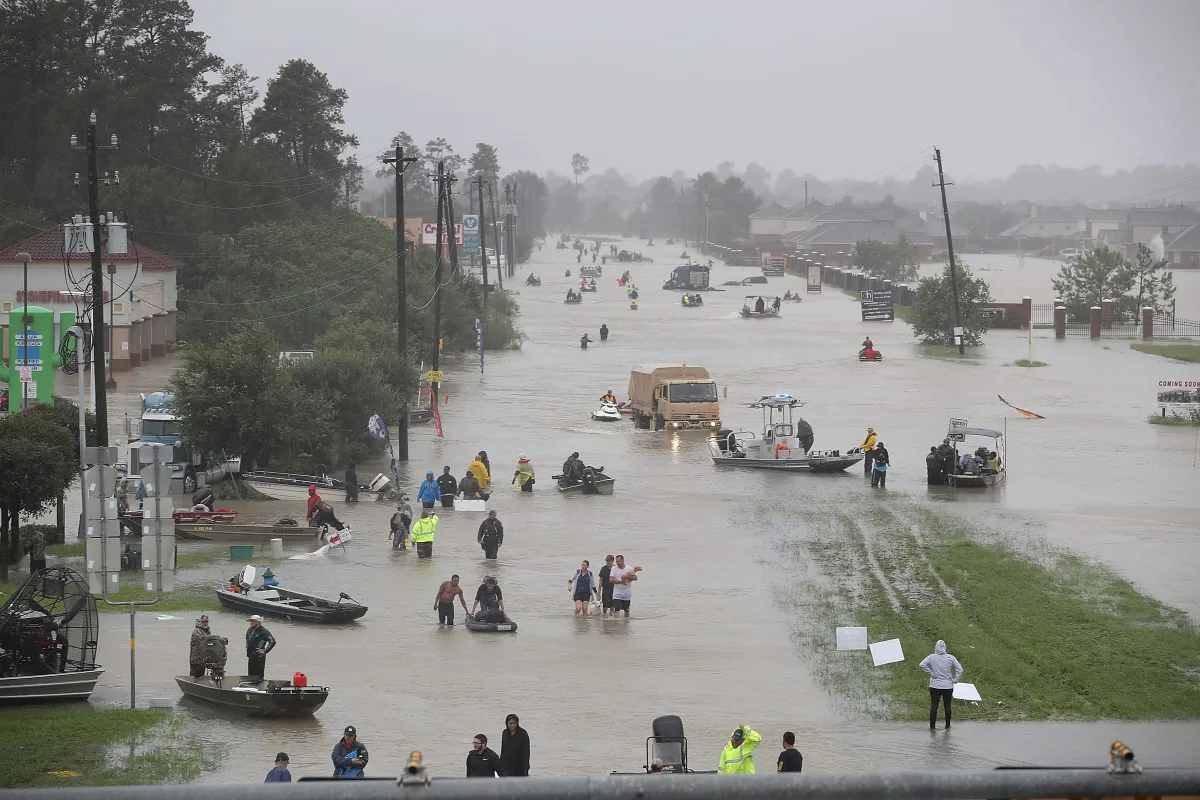 Photo: Hurricane Harvey, via static1.businessinsider.com
After Harvey's unprecedented flooding, FEMA began updating maps throughout the region. Properties that had never flooded, and weren't considered at risk, suddenly found themselves in high-risk zones when new maps were released in 2021. Homeowners faced a choice: purchase flood insurance that could cost thousands annually, or risk losing their mortgage if their lender discovered the change.
This wasn't just a Houston problem. Similar remapping has affected communities from North Carolina's coast to California's Central Valley, often catching homeowners completely off guard.
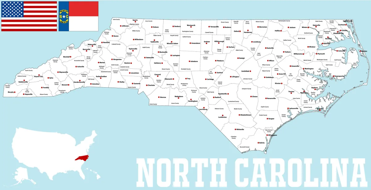 Photo: North Carolina, via www.guideoftheworld.com
The Insurance Shock Nobody Warns You About
When your property gets remapped into a flood zone, the financial impact hits immediately. Mortgage lenders require flood insurance for properties in high-risk areas — it's federal law. This insurance typically costs $400-2,000 annually, depending on your home's elevation and flood risk level.
But here's the cruel twist: even if you've never experienced flooding, even if your neighbors think the new designation is wrong, you still need the insurance. FEMA's maps are legally binding for mortgage purposes, regardless of local opinion or personal experience.
Some homeowners discover they can appeal the new designation, but this process requires hiring surveyors and engineers to prove their property's elevation puts it at lower risk than FEMA calculated. These appeals can cost thousands and take months to resolve — assuming they succeed.
Why Maps Lag Behind Reality
FEMA's mapping challenges go beyond simple bureaucratic delays. Climate change is altering precipitation patterns faster than maps can be updated. Urban development is changing water flow in real time. Aging infrastructure — storm drains, levees, retention ponds — affects flood risk but might not be reflected in maps for years.
The agency openly acknowledges this problem. In many areas, FEMA maps are based on data from the 1970s and 1980s, before significant development changed local hydrology. These maps might accurately reflect historical risk but poorly predict future flooding.
Some communities have grown frustrated with FEMA's pace and commissioned their own flood studies. But mortgage lenders still rely on official FEMA maps, creating situations where local data shows lower risk while federal maps require expensive insurance.
The Remapping Timeline Nobody Explains
FEMA doesn't remap randomly. The agency follows a structured process that homeowners can track — if they know where to look. When FEMA begins studying an area, they announce it publicly. Draft maps are released for community review. Local governments and residents can submit comments. Final maps are published with effective dates, usually 6-18 months in the future.
This timeline gives homeowners some warning, but many miss these announcements entirely. FEMA notifications go to local governments, not individual property owners. Unless your city actively communicates about ongoing studies, you might not learn about potential changes until new maps take effect.
What Homeowners Can Actually Do
Smart homeowners monitor FEMA's mapping activities in their area. The agency's website shows ongoing studies and proposed changes. Some areas offer notification services that alert residents when mapping updates affect their neighborhood.
When buying a home, consider flood risk beyond current maps. Look at topography, proximity to water bodies, and historical flooding — even outside official flood zones. Some buyers purchase flood insurance voluntarily, even in low-risk areas, because it's cheaper than waiting until it becomes mandatory.
If you're caught in a remapping, explore your options quickly. Elevation certificates can sometimes prove your home sits higher than FEMA assumed. Some homeowners qualify for lower-cost Preferred Risk Policies if they purchase insurance before remapping takes effect.
The Reality of Living with Fluid Risk
Flood maps aren't GPS coordinates — they're best guesses based on available data and computer models. As that data improves and conditions change, the maps change too. Homeowners who understand this reality make different decisions than those who treat flood zones as permanent features.
Your property's flood risk isn't determined when you buy — it's constantly being reassessed. That assessment might not change for decades, or it might change next year when FEMA releases updated maps. The only certainty is that flood risk, like the weather that creates it, remains in constant motion.